
Flood Study Benefits Before Commercial Site Development
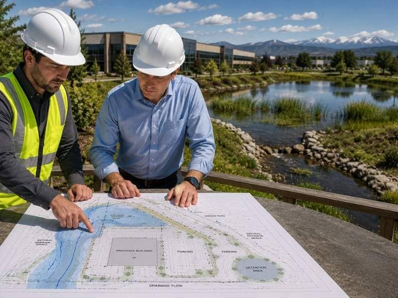
A flood study is an engineering review that shows how likely a piece of land is to flood and how high the water could rise. It pulls together flood maps, rainfall data and the shape of the land to model where water goes during a big storm. For a commercial project, that early answer shapes almost every choice that follows.
Find Out if a Site Is at Risk of Flooding
You can’t fix a flood risk you don’t know about. A flood study checks federal flood maps and studies the site itself to find the spots that fill with water during heavy rain. It looks at nearby creeks, low ground and the path storm runoff takes across the property. That gives a clear picture of what the land does in a real storm.
Plenty of sites that look dry turn out to carry real risk. Flooding is the most common and costliest natural disaster in the country, and it doesn’t stay inside the lines on a map. Federal flood insurance data shows that close to a third of flood claims come from outside high-risk zones. A study catches that hidden risk before a single truck shows up.
Learning this early saves real money. When a developer knows the flood risk up front, they can change the plan on paper instead of tearing out finished work later. Buying land without this knowledge is a gamble, and floods have a way of collecting on that bet.
Use the Results to Plan a Safer Site
A flood study is only useful if it shapes the plan. Once engineers know how high water can rise and where it collects, they can place buildings on the safest, highest parts of the site. They can set finished floors above the expected flood level so water stays out during a storm. Roads and parking lots can go in spots where a little flooding won’t shut the whole site down.
The study also guides the parts people don’t see. Engineers can steer utilities, power gear and loading areas away from the wettest ground. They can shape the site so a big storm has somewhere safe to send its water. Good placement early on means the site keeps working even when the weather doesn’t.
Meet Local Floodplain Requirements
Building in or near a floodplain comes with its own set of rules. Local floodplain offices review projects to make sure new construction won’t make flooding worse for the property or its neighbors. They often want proof of the base flood level and a plan that keeps the building above it. A flood study gives reviewers the numbers they need to sign off.
Doing the study early keeps a project on schedule. When the floodplain review starts and the flood data is already in hand, approval moves faster. Show up without it, and the project can sit and wait while questions pile up. On a commercial build, that kind of delay burns money every week it drags on.
Cut Future Repair Costs
Flood damage is brutal and expensive, and it tends to come back. Water that reaches a building can ruin floors, walls, wiring and equipment in a matter of hours. Pavement cracks and lifts when floodwater soaks the ground beneath it. Fixing all that after the fact costs far more than designing around the risk from day one.
A project built with flood risk in mind holds up better over time. Raised buildings, protected utilities and smart grading all cut the odds of a costly flood. Lower risk can also mean lower flood insurance costs, which adds up over the life of a commercial property. Spend a little on planning now, and you skip the much bigger bills that floods leave behind.
Make Smarter Building Decisions
Good decisions run on good information, and a flood study delivers it. Before anyone commits money, the study tells developers, owners and engineers exactly what they’re dealing with. That data can shape the whole project, including where the buildings sit and how much to budget for site work. In some cases it even helps a buyer decide whether a piece of land is worth the trouble at all.
The best time to learn all this is before the deal closes, not after the foundation is poured. A flood study turns a big unknown into a clear set of facts. With those facts in hand, everyone at the table can plan with their eyes open instead of hoping the weather cooperates.
Frequently Asked Questions
What is a flood study?
It’s an engineering review of how likely a site is to flood and how deep the water might get. The study combines flood maps, rain records and the lay of the land to model a big storm. The result shows where water goes and how high it rises.
Why is a flood study important before development?
It reveals risk while there’s still time to plan around it. Fixing a flood problem on paper costs little, but fixing it after construction costs a lot. The study also keeps people and property safer and helps a project meet local rules. Skipping it means building half blind.
When is a flood study required?
Local offices usually require one when a project sits in or near a mapped floodplain. Any commercial build close to a creek, river or low-lying area is a strong candidate. Even outside those zones, a study is smart, since flooding often hits ground the maps call low-risk.
How long does a flood study take?
It depends on the size of the site and how much data already exists. A simple review can wrap up in a couple of weeks, while a detailed model of a large or tricky site can take a month or more. Starting early keeps the study off the project’s critical path.
Who performs a flood study?
A civil engineer or a water resources engineer usually runs the study, often with survey data on the site’s elevations. These are people trained in how water moves and how floodplains work. On bigger projects, they may team up with a hydrologist or a floodplain specialist.
